
Shahpura topographic map
Interactive map
Click on the map to display elevation.
About this map
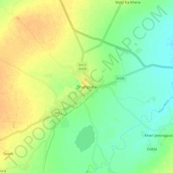
Name: Shahpura topographic map, elevation, terrain.
Location: Shahpura, Shahpura Tehsil, Bhilwara, Rajasthan, 311400, India (25.58526 74.88746 25.66526 74.96746)
Average elevation: 1,214 ft
Minimum elevation: 1,168 ft
Maximum elevation: 1,260 ft
Other topographic maps
Click on a map to view its topography, its elevation and its terrain.
Rampura
India > Rajasthan > Shahpura Tehsil
Rampura, Shahpura Tehsil, Jaipur(Rural) District, Rajasthan, India
Average elevation: 1,437 ft
Shahpura Tehsil
India > Rajasthan > Shahpura Tehsil
Shahpura Tehsil, Jaipur, Rajasthan, India
Average elevation: 1,598 ft
Paparikhera
India > Rajasthan > Shahpura Tehsil > Paparikhera
Paparikhera, Shahpura Tehsil, Bhilwara, Rajasthan, 311022, India
Average elevation: 1,286 ft