
Jolfa topographic map
Interactive map
Click on the map to display elevation.
About this map
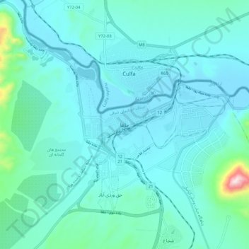
Name: Jolfa topographic map, elevation, terrain.
Average elevation: 2,510 ft
Minimum elevation: 2,283 ft
Maximum elevation: 4,216 ft
Other topographic maps
Click on a map to view its topography, its elevation and its terrain.
Hadishahr
Iran > East Azerbaijan Province > Jolfa County > دهستان شجاع
Hadishahr, دهستان شجاع, بخش مرکزی, Jolfa County, East Azerbaijan Province, Iran
Average elevation: 3,291 ft