Geolocate

黄坛镇 topographic map

Interactive map

Click on the map to display elevation.

About this map

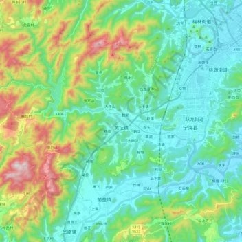
Name: 黄坛镇 topographic map, elevation, terrain.

Location: 黄坛镇, 宁海县, 宁波市, 浙江省, 中国 (29.22388 121.15835 29.36771 121.38728)

Average elevation: 745 ft

Minimum elevation: 3 ft

Maximum elevation: 2,930 ft

Other topographic maps

Click on a map to view its topography, its elevation and its terrain.

岭脚

中国 > 浙江省 > 宁海县

岭脚, 跃龙街道, 宁海县, 宁波市, 浙江省, 中国

Average elevation: 233 ft

大佳何镇

中国 > 浙江省 > 宁海县

大佳何镇, 宁海县, 宁波市, 浙江省, 中国

Average elevation: 390 ft

平窑

中国 > 浙江省 > 宁海县 > 茶院乡

平窑, 茶院乡, 宁海县, 宁波市, 浙江省, 中国

Average elevation: 213 ft

下沿盘

中国 > 浙江省 > 宁海县 > 茶院乡

下沿盘, 茶院乡, 宁海县, 宁波市, 浙江省, 中国

Average elevation: 62 ft

长街镇

中国 > 浙江省 > 宁海县

长街镇, 宁海县, 宁波市, 浙江省, 中国

Average elevation: 43 ft

下洋

中国 > 浙江省 > 宁海县 > 强蛟镇

下洋, 强蛟镇, 宁海县, 宁波市, 浙江省, 中国

Average elevation: 141 ft

竹口储

中国 > 浙江省 > 宁海县 > 桃源街道

竹口储, 桃源街道, 宁海县, 宁波市, 浙江省, 中国

Average elevation: 207 ft