
East Bremerton topographic map
Interactive map
Click on the map to display elevation.
About this map
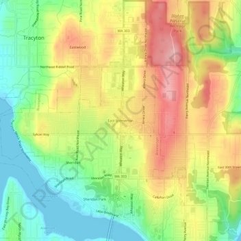
Name: East Bremerton topographic map, elevation, terrain.
Average elevation: 236 ft
Minimum elevation: -3 ft
Maximum elevation: 499 ft
Other topographic maps
Click on a map to view its topography, its elevation and its terrain.
Sheridan
United States > Washington > Kitsap County > Bremerton
Sheridan, Bremerton, Kitsap County, Washington, 98310, United States
Average elevation: 164 ft
Bremerton
United States > Washington > Kitsap County > Bremerton > Bremerton
Bremerton, Kitsap County, Washington, 98337, United States
Average elevation: 217 ft