
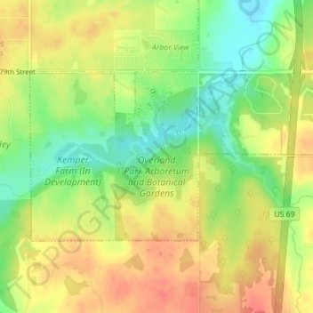
Overland Park Arboretum and Botanical Gardens topographic map
Interactive map
Click on the map to display elevation.
About this map
Name: Overland Park Arboretum and Botanical Gardens topographic map, elevation, terrain.
Average elevation: 1,001 ft
Minimum elevation: 906 ft
Maximum elevation: 1,076 ft
Other topographic maps
Click on a map to view its topography, its elevation and its terrain.
Overland Park
United States > Kansas > Johnson County > Overland Park
Overland Park, Johnson County, Kansas, 66204, United States
Average elevation: 945 ft
Elmhurst
United States > Kansas > Johnson County > Overland Park > Elmhurst
Elmhurst, Overland Park, Johnson County, Kansas, 66204, United States
Average elevation: 1,027 ft