
Limbach topographic map
Interactive map
Click on the map to display elevation.
About this map
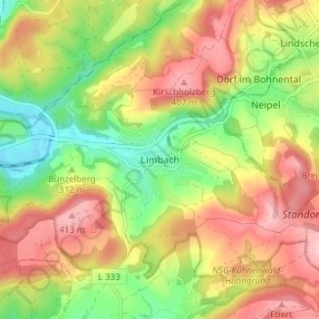
Name: Limbach topographic map, elevation, terrain.
Location: Limbach, Landkreis Saarlouis, Saarland, 66839, Deutschland (49.45544 6.87928 49.49544 6.91928)
Average elevation: 1,079 ft
Minimum elevation: 771 ft
Maximum elevation: 1,385 ft
Other topographic maps
Click on a map to view its topography, its elevation and its terrain.
Limbach
Deutschland > Saarland > Limbach
Limbach, Schmelz, Landkreis Saarlouis, Saarland, Deutschland
Average elevation: 1,079 ft