
Tetela del Volcán topographic map
Interactive map
Click on the map to display elevation.
About this map
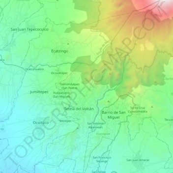
Name: Tetela del Volcán topographic map, elevation, terrain.
Location: Tetela del Volcán, Morelos, México (18.82084 -98.77539 19.01555 -98.63295)
Average elevation: 7,904 ft
Minimum elevation: 5,407 ft
Maximum elevation: 16,276 ft