
Ringvaart van de Zuidplaspolder topographic map
Interactive map
Click on the map to display elevation.
About this map
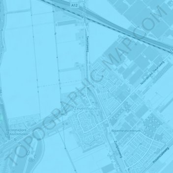
Name: Ringvaart van de Zuidplaspolder topographic map, elevation, terrain.
Average elevation: -13 ft
Minimum elevation: -30 ft
Maximum elevation: 3 ft
Other topographic maps
Click on a map to view its topography, its elevation and its terrain.
Oud Verlaat
Nederland > Zuid-Holland > Zevenhuizen
Oud Verlaat, Zevenhuizen, Zuidplas, Zuid-Holland, Nederland, 2761 DX, Nederland
Average elevation: -13 ft
Vijfde Dorp
Nederland > Zuid-Holland > Zevenhuizen
Vijfde Dorp, Zevenhuizen, Zuidplas, Zuid-Holland, Nederland
Average elevation: -16 ft