
Biesbosch topographic map
Interactive map
Click on the map to display elevation.
About this map
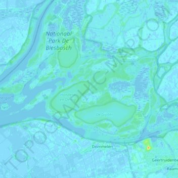
Name: Biesbosch topographic map, elevation, terrain.
Location: Biesbosch, Drimmelen, Noord-Brabant, Nederland (51.71128 4.69855 51.76657 4.85313)
Average elevation: 7 ft
Minimum elevation: -13 ft
Maximum elevation: 108 ft
Other topographic maps
Click on a map to view its topography, its elevation and its terrain.
Drimmelen
Nederland > Noord-Brabant > Drimmelen
Drimmelen, Noord-Brabant, Nederland
Average elevation: 3 ft
Wagenberg
Nederland > Noord-Brabant > Drimmelen
Wagenberg, Drimmelen, Noord-Brabant, Nederland
Average elevation: 0 ft