
Aschaffenburg topographic map
Interactive map
Click on the map to display elevation.
About this map
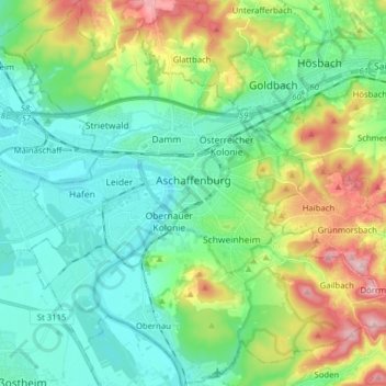
Name: Aschaffenburg topographic map, elevation, terrain.
Location: Aschaffenburg, Bavière, Allemagne (49.92006 9.08025 50.02128 9.23800)
Average elevation: 584 ft
Minimum elevation: 341 ft
Maximum elevation: 1,201 ft