
Thank you for supporting this site ❤️
Make a donation
Make a donation
Gear up for your next adventure:
As an Amazon Associate, this site earns from qualifying purchases at no extra cost to you.
Çamlık topographic map
Click on the map to display elevation.
Thank you for supporting this site ❤️
Make a donation
Make a donation
Gear up for your next adventure:
As an Amazon Associate, this site earns from qualifying purchases at no extra cost to you.
About this map
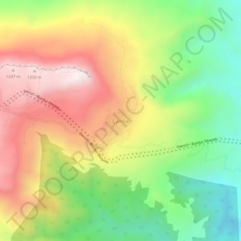
Name: Çamlık topographic map, elevation, terrain.
Location: Çamlık, Bucak, Burdur, Mediterranean Region, Turkey (37.47208 30.68166 37.51208 30.72166)
Average elevation: 2,684 ft
Minimum elevation: 1,299 ft
Maximum elevation: 4,229 ft
Thank you for supporting this site ❤️
Make a donation
Make a donation
Gear up for your next adventure:
As an Amazon Associate, this site earns from qualifying purchases at no extra cost to you.