
Otsego Township topographic map
Interactive map
Click on the map to display elevation.
About this map
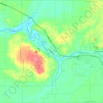
Name: Otsego Township topographic map, elevation, terrain.
Average elevation: 751 ft
Minimum elevation: 643 ft
Maximum elevation: 994 ft
Other topographic maps
Click on a map to view its topography, its elevation and its terrain.
Allegan State Game Area
United States > Michigan > Allegan County > Allegan
Allegan State Game Area, Allegan, Clyde Township, Allegan County, Michigan, United States
Average elevation: 676 ft
Hopkins
United States > Michigan > Allegan County
Hopkins, Hopkins Township, Allegan County, Michigan, 49328, United States
Average elevation: 709 ft
Pullman
United States > Michigan > Allegan County > Pullman
Pullman, Lee Township, Allegan County, Michigan, 49450, United States
Average elevation: 653 ft
Cheshire Township
United States > Michigan > Allegan County
Cheshire Township, Allegan County, Michigan, United States
Average elevation: 715 ft