
Carumas topographic map
Interactive map
Click on the map to display elevation.
About this map
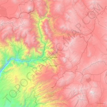
Name: Carumas topographic map, elevation, terrain.
Location: Carumas, Mariscal Nieto, Moquegua, Perú (-16.95941 -70.90546 -16.46145 -69.99505)
Average elevation: 12,874 ft
Minimum elevation: 4,259 ft
Maximum elevation: 18,957 ft
Other topographic maps
Click on a map to view its topography, its elevation and its terrain.