
Waiblingen topographic map
Click on the map to display elevation.
About this map
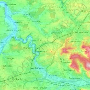
Name: Waiblingen topographic map, elevation, terrain.
Location: Waiblingen, Rems-Murr-Kreis, Baden-Württemberg, Germany (48.81051 9.27616 48.90912 9.44298)
Average elevation: 919 ft
Minimum elevation: 650 ft
Maximum elevation: 1,499 ft
Other topographic maps
Click on a map to view its topography, its elevation and its terrain.
Kleinhegnach
Germany > Baden-Württemberg > Rems-Murr-Kreis > Waiblingen > Neustadt
Average elevation: 909 ft
Dörnich
Germany > Baden-Württemberg > Rems-Murr-Kreis > Sulzbach an der Murr
Average elevation: 1,342 ft