
廖家垄袁 topographic map
Interactive map
Click on the map to display elevation.
About this map
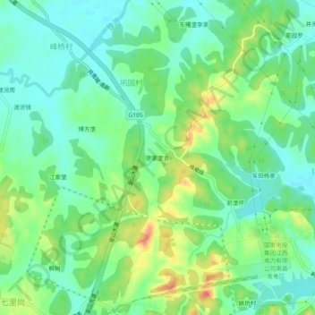
Name: 廖家垄袁 topographic map, elevation, terrain.
Location: 廖家垄袁, 巩固村, 樵舍镇, 南昌经开区, 新建区, 南昌市, 江西省, 中国 (28.85321 115.94020 28.89321 115.98020)
Average elevation: 98 ft
Minimum elevation: 33 ft
Maximum elevation: 223 ft