
Isla Traiguén topographic map
Interactive map
Click on the map to display elevation.
About this map
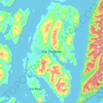
Name: Isla Traiguén topographic map, elevation, terrain.
Average elevation: 571 ft
Minimum elevation: -3 ft
Maximum elevation: 3,960 ft
Other topographic maps
Click on a map to view its topography, its elevation and its terrain.
Aysén
Chile > Región Aysén del General Carlos Ibáñez del Campo > Aysén
Aysén, Provincia de Aysén, Región Aysén del General Carlos Ibáñez del Campo, Chile
Average elevation: 1,020 ft