
Reguenga topographic map
Interactive map
Click on the map to display elevation.
About this map
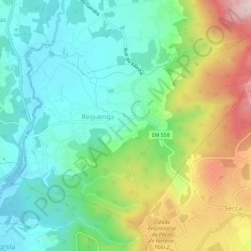
Name: Reguenga topographic map, elevation, terrain.
Location: Reguenga, Santo Tirso, Porto, Portugal (41.26215 -8.47033 41.28689 -8.42927)
Average elevation: 699 ft
Minimum elevation: 387 ft
Maximum elevation: 1,388 ft
Other topographic maps
Click on a map to view its topography, its elevation and its terrain.
Merouços
Portugal > Porto > Santo Tirso > Merouços
Merouços, Santo Tirso, Santo Tirso, Couto (Santa Cristina e São Miguel) e Burgães, Santo Tirso, Porto, 4780-510, Portugal
Average elevation: 446 ft