
Thank you for supporting this site ❤️
Make a donation
Make a donation
Gear up for your next adventure:
As an Amazon Associate, this site earns from qualifying purchases at no extra cost to you.
Wansan-gu topographic map
Click on the map to display elevation.
Thank you for supporting this site ❤️
Make a donation
Make a donation
Gear up for your next adventure:
As an Amazon Associate, this site earns from qualifying purchases at no extra cost to you.
About this map
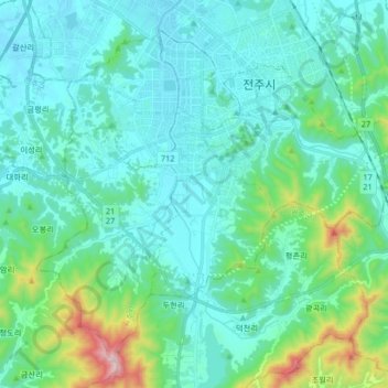
Name: Wansan-gu topographic map, elevation, terrain.
Location: Wansan-gu, Jeonju-si, North Jeolla, South Korea (35.72848 127.05204 35.84231 127.21716)
Average elevation: 453 ft
Minimum elevation: 46 ft
Maximum elevation: 2,530 ft
Thank you for supporting this site ❤️
Make a donation
Make a donation
Gear up for your next adventure:
As an Amazon Associate, this site earns from qualifying purchases at no extra cost to you.