
Pelayangan topographic map
Interactive map
Click on the map to display elevation.
About this map
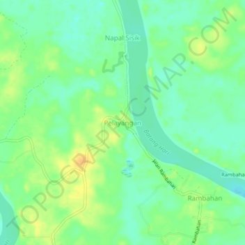
Name: Pelayangan topographic map, elevation, terrain.
Location: Pelayangan, Batanghari, Jambi, Indonesia (-1.72184 103.19721 -1.68184 103.23721)
Average elevation: 62 ft
Minimum elevation: 23 ft
Maximum elevation: 115 ft
Other topographic maps
Click on a map to view its topography, its elevation and its terrain.
Kampung Pulau
Indonesia > Jambi > Batanghari
Kampung Pulau, Batanghari, Jambi, Indonesia
Average elevation: 52 ft
Sungai Air Putih
Indonesia > Jambi > Batanghari
Sungai Air Putih, Batanghari, Jambi, Indonesia
Average elevation: 102 ft