
Gurisi topographic map
Interactive map
Click on the map to display elevation.
About this map
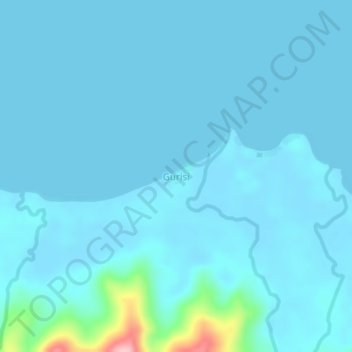
Name: Gurisi topographic map, elevation, terrain.
Location: Gurisi, West New Britain, Islands Region, Papua New Guinea (-5.50664 148.69752 -5.46664 148.73752)
Average elevation: 39 ft
Minimum elevation: 0 ft
Maximum elevation: 564 ft
Other topographic maps
Click on a map to view its topography, its elevation and its terrain.
Bialla
Papua New Guinea > West New Britain
Bialla, West New Britain, Islands Region, Papua New Guinea
Average elevation: 292 ft
Bismarck Archipelago
Papua New Guinea > West New Britain
Bismarck Archipelago, West New Britain, Islands Region, Papua New Guinea
Average elevation: 0 ft
Hulem
Papua New Guinea > West New Britain
Hulem, West New Britain, Islands Region, Papua New Guinea
Average elevation: 1,404 ft