
Perlis topographic map
Interactive map
Click on the map to display elevation.
About this map
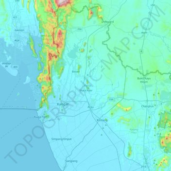
Name: Perlis topographic map, elevation, terrain.
Location: Perlis, Malaysia (6.25327 100.12042 6.72608 100.37068)
Average elevation: 164 ft
Minimum elevation: -7 ft
Maximum elevation: 2,343 ft
Other topographic maps
Click on a map to view its topography, its elevation and its terrain.