
Lindauer Hütte topographic map
Interactive map
Click on the map to display elevation.
About this map
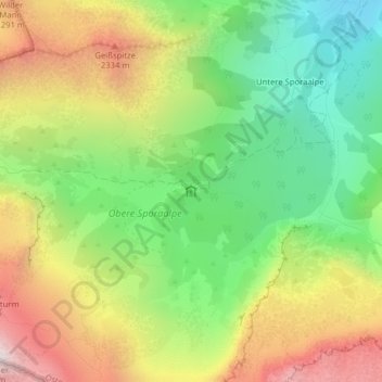
Name: Lindauer Hütte topographic map, elevation, terrain.
Average elevation: 6,234 ft
Minimum elevation: 4,436 ft
Maximum elevation: 8,570 ft
Other topographic maps
Click on a map to view its topography, its elevation and its terrain.
Tilisunahütte
Oostenrijk > Vorarlberg > Bezirk Bludenz > Gemeinde Tschagguns
Tilisunahütte, 12, Bilkengrat, Gemeinde Tschagguns, Bezirk Bludenz, Vorarlberg, 6774, Oostenrijk
Average elevation: 6,932 ft