
Thank you for supporting this site ❤️
Make a donation
Make a donation
Gear up for your next adventure:
As an Amazon Associate, this site earns from qualifying purchases at no extra cost to you.
Transylvania topographic map
Click on the map to display elevation.
Thank you for supporting this site ❤️
Make a donation
Make a donation
Gear up for your next adventure:
As an Amazon Associate, this site earns from qualifying purchases at no extra cost to you.
About this map
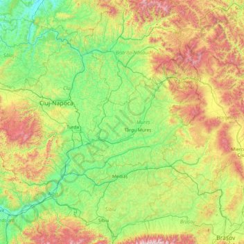
Name: Transylvania topographic map, elevation, terrain.
Location: Transylvania, Band, Mureș, 547065, Romania (45.59716 23.37403 47.59716 25.37403)
Average elevation: 2,126 ft
Minimum elevation: 509 ft
Maximum elevation: 8,068 ft
Thank you for supporting this site ❤️
Make a donation
Make a donation
Gear up for your next adventure:
As an Amazon Associate, this site earns from qualifying purchases at no extra cost to you.