
Wormley topographic map
Interactive map
Click on the map to display elevation.
About this map
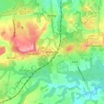
Name: Wormley topographic map, elevation, terrain.
Location: Wormley, Waverley, Surrey, England, GU8 5UA, United Kingdom (51.11541 -0.66671 51.15541 -0.62671)
Average elevation: 285 ft
Minimum elevation: 151 ft
Maximum elevation: 499 ft