
Guildford topographic map
Interactive map
Click on the map to display elevation.
About this map
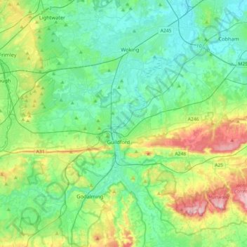
Name: Guildford topographic map, elevation, terrain.
Location: Guildford, Surrey, South East, England, United Kingdom (51.17319 -0.74834 51.33152 -0.38717)
Average elevation: 243 ft
Minimum elevation: 39 ft
Maximum elevation: 840 ft