
Monte Civetta topographic map
Interactive map
Click on the map to display elevation.
About this map
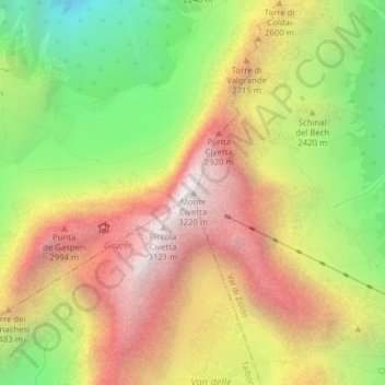
Name: Monte Civetta topographic map, elevation, terrain.
Location: Monte Civetta, Alleghe, BL, Veneto, Italia (46.38008 12.05330 46.38018 12.05340)
Average elevation: 7,785 ft
Minimum elevation: 4,941 ft
Maximum elevation: 10,469 ft