
Gowrie topographic map
Interactive map
Click on the map to display elevation.
About this map
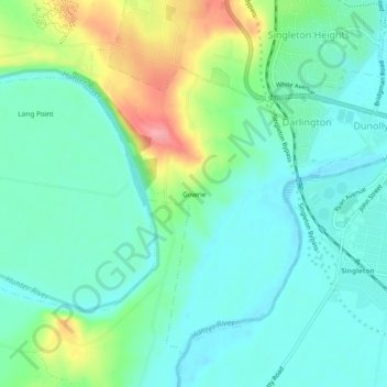
Name: Gowrie topographic map, elevation, terrain.
Location: Gowrie, Singleton Council, New South Wales, Australia (-32.58500 151.12556 -32.54500 151.16556)
Average elevation: 194 ft
Minimum elevation: 98 ft
Maximum elevation: 440 ft
Other topographic maps
Click on a map to view its topography, its elevation and its terrain.
Gowrie
Australia > New South Wales > Gowrie
Gowrie, Tamworth Regional Council, New South Wales, Australia
Average elevation: 1,690 ft