
Karahacılı topographic map
Interactive map
Click on the map to display elevation.
About this map
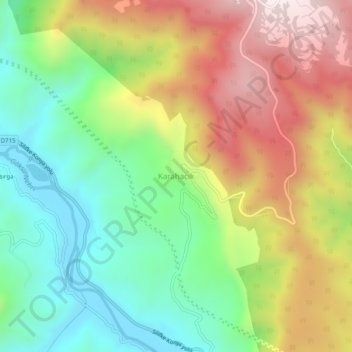
Name: Karahacılı topographic map, elevation, terrain.
Location: Karahacılı, Silifke, Mersin, Mediterranean Region, Turkey (36.41266 33.78122 36.45266 33.82122)
Average elevation: 1,188 ft
Minimum elevation: 95 ft
Maximum elevation: 2,654 ft
Other topographic maps
Click on a map to view its topography, its elevation and its terrain.