
Algarrobos Arriba topographic map
Interactive map
Click on the map to display elevation.
About this map
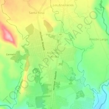
Name: Algarrobos Arriba topographic map, elevation, terrain.
Average elevation: 525 ft
Minimum elevation: 240 ft
Maximum elevation: 909 ft
Other topographic maps
Click on a map to view its topography, its elevation and its terrain.
Los Algarrobos
Panamá > Chiriquí > Distrito Dolega > Los Agarrobos
Los Algarrobos, Los Agarrobos, Distrito Dolega, Chiriquí, Panamá
Average elevation: 420 ft