
Zirahuén topographic map
Interactive map
Click on the map to display elevation.
About this map
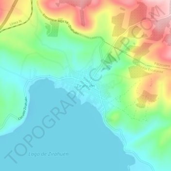
Name: Zirahuén topographic map, elevation, terrain.
Location: Zirahuén, Salvador Escalante, Michoacán de Ocampo, México (19.43325 -101.75159 19.47325 -101.71159)
Average elevation: 7,060 ft
Minimum elevation: 6,804 ft
Maximum elevation: 7,651 ft