
Sarangpani Lake topographic map
Interactive map
Click on the map to display elevation.
About this map
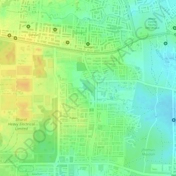
Name: Sarangpani Lake topographic map, elevation, terrain.
Average elevation: 1,608 ft
Minimum elevation: 1,555 ft
Maximum elevation: 1,657 ft
Other topographic maps
Click on a map to view its topography, its elevation and its terrain.
Van Vihar National Park
India > Madhya Pradesh > Huzur Tahsil > Bhopal
Van Vihar National Park, Bhopal, Huzur Tahsil, Bhopal, Madhya Pradesh, 462001, India
Average elevation: 1,742 ft