
Lerga topographic map
Interactive map
Click on the map to display elevation.
About this map
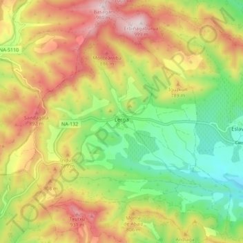
Name: Lerga topographic map, elevation, terrain.
Location: Lerga, Navarra, España (42.53486 -1.53470 42.59749 -1.46249)
Average elevation: 2,300 ft
Minimum elevation: 1,519 ft
Maximum elevation: 3,215 ft