
黄泥川村 topographic map
Interactive map
Click on the map to display elevation.
About this map
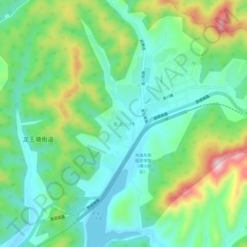
Name: 黄泥川村 topographic map, elevation, terrain.
Location: 黄泥川村, 旅顺口区, 大连市, 辽宁省, 中国 (38.83401 121.41467 38.87401 121.45467)
Average elevation: 318 ft
Minimum elevation: 16 ft
Maximum elevation: 1,007 ft
Other topographic maps
Click on a map to view its topography, its elevation and its terrain.