
Thank you for supporting this site ❤️
Make a donation
Make a donation
Gear up for your next adventure:
As an Amazon Associate, this site earns from qualifying purchases at no extra cost to you.
Ampary topographic map
Click on the map to display elevation.
Thank you for supporting this site ❤️
Make a donation
Make a donation
Gear up for your next adventure:
As an Amazon Associate, this site earns from qualifying purchases at no extra cost to you.
About this map
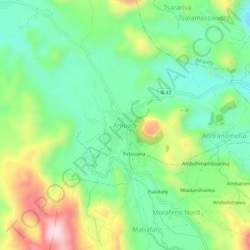
Name: Ampary topographic map, elevation, terrain.
Location: Ampary, Itasy, Province d’Antananarivo, Madagascar (-19.11553 46.69122 -19.07553 46.73122)
Average elevation: 4,551 ft
Minimum elevation: 4,114 ft
Maximum elevation: 5,361 ft
Thank you for supporting this site ❤️
Make a donation
Make a donation
Gear up for your next adventure:
As an Amazon Associate, this site earns from qualifying purchases at no extra cost to you.