
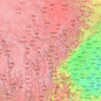
དཀར་མཛེས 甘孜藏族自治州 topographic map
Interactive map
Click on the map to display elevation.
About this map
Name: དཀར་མཛེས 甘孜藏族自治州 topographic map, elevation, terrain.
Location: དཀར་མཛེས 甘孜藏族自治州, Sichuan, RPC (27.96542 97.34738 34.21023 102.49010)
Average elevation: 12,139 ft
Minimum elevation: 1,063 ft
Maximum elevation: 23,343 ft
Other topographic maps
Click on a map to view its topography, its elevation and its terrain.