
Sparti topographic map
Interactive map
Click on the map to display elevation.
About this map
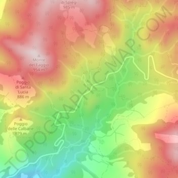
Name: Sparti topographic map, elevation, terrain.
Location: Sparti, Pieve Santo Stefano, AR, Tuscany, 52036, Italy (43.68117 12.05787 43.70117 12.07787)
Average elevation: 2,425 ft
Minimum elevation: 1,575 ft
Maximum elevation: 3,120 ft