
Parque Natural de los Calares del Mundo y de la Sima topographic map
Interactive map
Click on the map to display elevation.
About this map
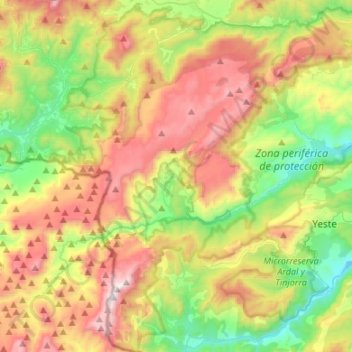
Name: Parque Natural de los Calares del Mundo y de la Sima topographic map, elevation, terrain.
Average elevation: 3,691 ft
Minimum elevation: 1,923 ft
Maximum elevation: 6,171 ft
Other topographic maps
Click on a map to view its topography, its elevation and its terrain.
Graya
España > Castilla-La Mancha > Yeste > Graya
Graya, Yeste, Albacete, Castilla-La Mancha, España
Average elevation: 3,058 ft
Cerro Lobo
España > Castilla-La Mancha > Yeste
Cerro Lobo, Yeste, Albacete, Castilla-La Mancha, España
Average elevation: 2,913 ft
Los Argüellos
España > Castilla-La Mancha > Yeste
Los Argüellos, Yeste, Albacete, Castilla-La Mancha, España
Average elevation: 2,201 ft