
Le Viala Haut topographic map
Interactive map
Click on the map to display elevation.
About this map
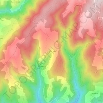
Name: Le Viala Haut topographic map, elevation, terrain.
Average elevation: 3,448 ft
Minimum elevation: 2,559 ft
Maximum elevation: 4,094 ft
Other topographic maps
Click on a map to view its topography, its elevation and its terrain.
Recoulettes
France > Occitanie > Lozère > Barjac
Recoulettes, Barjac, Mende, Lozère, Occitanie, France métropolitaine, 48000, France
Average elevation: 2,654 ft