
Chilluévar topographic map
Interactive map
Click on the map to display elevation.
About this map
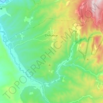
Name: Chilluévar topographic map, elevation, terrain.
Location: Chilluévar, Jaén, Andalusia, Spain (37.95529 -3.08724 38.01801 -2.96360)
Average elevation: 2,178 ft
Minimum elevation: 1,329 ft
Maximum elevation: 4,157 ft