
Esbeek topographic map
Interactive map
Click on the map to display elevation.
About this map
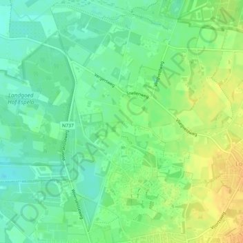
Name: Esbeek topographic map, elevation, terrain.
Location: Esbeek, Enschede, Overijssel, Nederland, 7524PN, Nederland (52.25519 6.88810 52.25537 6.88914)
Average elevation: 121 ft
Minimum elevation: 79 ft
Maximum elevation: 177 ft
Other topographic maps
Click on a map to view its topography, its elevation and its terrain.
Lonneker
Nederland > Overijssel > Enschede
Lonneker, Enschede, Overijssel, Nederland, 7524 CH, Nederland
Average elevation: 154 ft
Enschede
Nederland > Overijssel > Enschede
Enschede, Overijssel, Nederland, 7511GD, Nederland
Average elevation: 112 ft
Boekelo
Nederland > Overijssel > Enschede
Boekelo, Enschede, Overijssel, Nederland, 7548 AP, Nederland
Average elevation: 89 ft