
Ganshoren topographic map
Interactive map
Click on the map to display elevation.
About this map
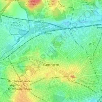
Name: Ganshoren topographic map, elevation, terrain.
Location: Ganshoren, Brussels Hoofdstedelijk Gewest, 1083, België (50.86575 4.29140 50.88210 4.32610)
Average elevation: 151 ft
Minimum elevation: 79 ft
Maximum elevation: 262 ft