
Izurza topographic map
Interactive map
Click on the map to display elevation.
About this map
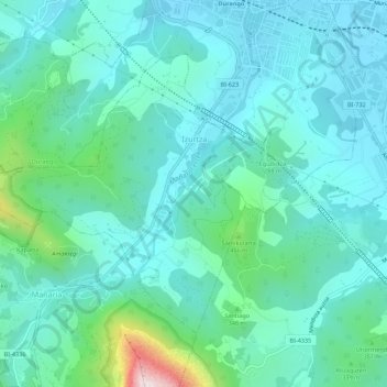
Name: Izurza topographic map, elevation, terrain.
Location: Izurza, Duranguesado, Vizcaya, País Vasco, 48213, España (43.13430 -2.68753 43.16335 -2.63249)
Average elevation: 804 ft
Minimum elevation: 364 ft
Maximum elevation: 2,897 ft
Other topographic maps
Click on a map to view its topography, its elevation and its terrain.
Mugarra
España > País Vasco > Izurza
Mugarra, Izurza, Vizcaya, País Vasco, 48212, España
Average elevation: 1,798 ft