
Dillon Reservoir topographic map
Interactive map
Click on the map to display elevation.
About this map
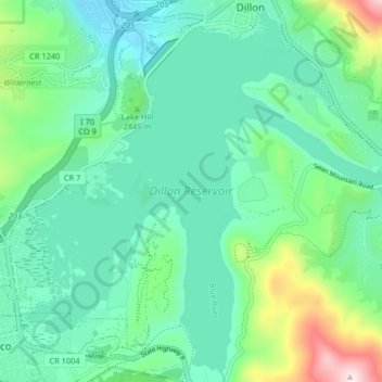
Name: Dillon Reservoir topographic map, elevation, terrain.
Average elevation: 9,213 ft
Minimum elevation: 8,760 ft
Maximum elevation: 10,758 ft
Other topographic maps
Click on a map to view its topography, its elevation and its terrain.
Silverthorne
Vereinigte Staaten von Amerika > Colorado > Silverthorne
Silverthorne, Summit County, Colorado, 80497, Vereinigte Staaten von Amerika
Average elevation: 9,459 ft