
Isser topographic map
Interactive map
Click on the map to display elevation.
About this map
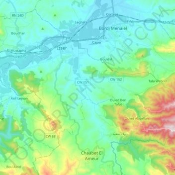
Name: Isser topographic map, elevation, terrain.
Location: Isser, Daïra Isser, Boumerdès, Algérie (36.65246 3.60171 36.73466 3.78209)
Average elevation: 512 ft
Minimum elevation: 46 ft
Maximum elevation: 2,234 ft
Other topographic maps
Click on a map to view its topography, its elevation and its terrain.
Timezrit
Algérie > Boumerdès > Daïra Isser
Timezrit, Daïra Isser, Boumerdès, Algérie
Average elevation: 1,768 ft
Chaabet El Ameur
Algérie > Boumerdès > Daïra Isser
Chaabet El Ameur, Daïra Isser, Boumerdès, 35008, Algérie
Average elevation: 1,066 ft