
Carrigaline topographic map
Interactive map
Click on the map to display elevation.
About this map
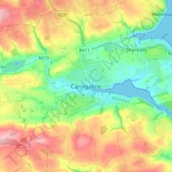
Name: Carrigaline topographic map, elevation, terrain.
Location: Carrigaline, County Cork, Munster, P43 HE16, Ireland (51.77496 -8.43227 51.85496 -8.35227)
Average elevation: 243 ft
Minimum elevation: -52 ft
Maximum elevation: 584 ft