
Couço topographic map
Interactive map
Click on the map to display elevation.
About this map
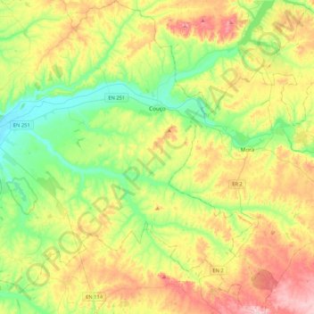
Name: Couço topographic map, elevation, terrain.
Location: Couço, Coruche, Santarém, Lezíria do Tejo, Alentejo, Portugal (38.77179 -8.41967 39.10029 -8.12431)
Average elevation: 361 ft
Minimum elevation: 49 ft
Maximum elevation: 856 ft