
Graz topographic map
Interactive map
Click on the map to display elevation.
About this map
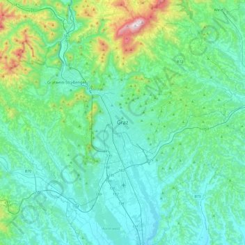
Name: Graz topographic map, elevation, terrain.
Location: Graz, Styria, 8011, Austria (46.91087 15.27828 47.23087 15.59828)
Average elevation: 1,581 ft
Minimum elevation: 981 ft
Maximum elevation: 4,731 ft