
Τόξο topographic map
Interactive map
Click on the map to display elevation.
About this map
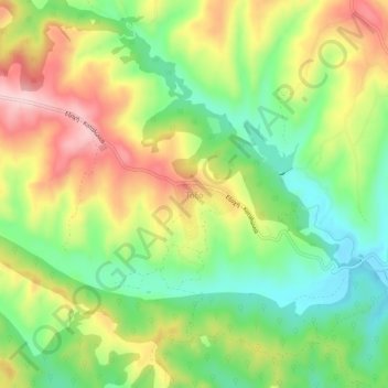
Name: Τόξο topographic map, elevation, terrain.
Average elevation: 774 ft
Minimum elevation: 427 ft
Maximum elevation: 1,214 ft
Other topographic maps
Click on a map to view its topography, its elevation and its terrain.
Πέλεκας
Greece > Macedonia and Thrace > Pieria Regional Unit > Katerini Municipality > Αρωνάς
Πέλεκας, Αρωνάς, Katerini Municipality, Pieria Regional Unit, Central Macedonia, Macedonia and Thrace, 601 50, Greece
Average elevation: 459 ft
Ράχη
Greece > Macedonia and Thrace > Pieria Regional Unit > Katerini Municipality
Ράχη, Katerini Municipality, Pieria Regional Unit, Central Macedonia, Macedonia and Thrace, 601 50, Greece
Average elevation: 663 ft