
Edmondsley topographic map
Interactive map
Click on the map to display elevation.
About this map
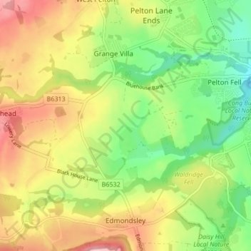
Name: Edmondsley topographic map, elevation, terrain.
Location: Edmondsley, County Durham, North East, England, United Kingdom (54.83129 -1.66987 54.87042 -1.61158)
Average elevation: 367 ft
Minimum elevation: 112 ft
Maximum elevation: 666 ft