
Thank you for supporting this site ❤️
Make a donation
Make a donation
Gear up for your next adventure:
As an Amazon Associate, this site earns from qualifying purchases at no extra cost to you.
Cocullo topographic map
Click on the map to display elevation.
Thank you for supporting this site ❤️
Make a donation
Make a donation
Gear up for your next adventure:
As an Amazon Associate, this site earns from qualifying purchases at no extra cost to you.
About this map
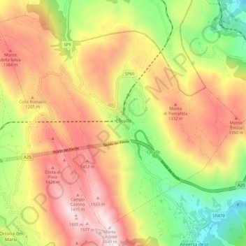
Name: Cocullo topographic map, elevation, terrain.
Location: Cocullo, L'Aquila, Abruzzo, Italy (41.99884 13.72206 42.06533 13.82380)
Average elevation: 3,488 ft
Minimum elevation: 1,453 ft
Maximum elevation: 5,446 ft
Thank you for supporting this site ❤️
Make a donation
Make a donation
Gear up for your next adventure:
As an Amazon Associate, this site earns from qualifying purchases at no extra cost to you.